AirPort Islamabad City Landinfo Portal
Cadastral Land Info System developed using Arcgis Experience
Team Members:
Muhammad Hamza
Niche:
WebGIS
Affiliation:
Local Project
Tech Stack:
Python (arcpy), AGOL
Team Members:
Muhammad Hamza
Niche:
WebGIS
Affiliation:
Local Project
Tech Stack:
Python (arcpy), AGOL
Project Description:
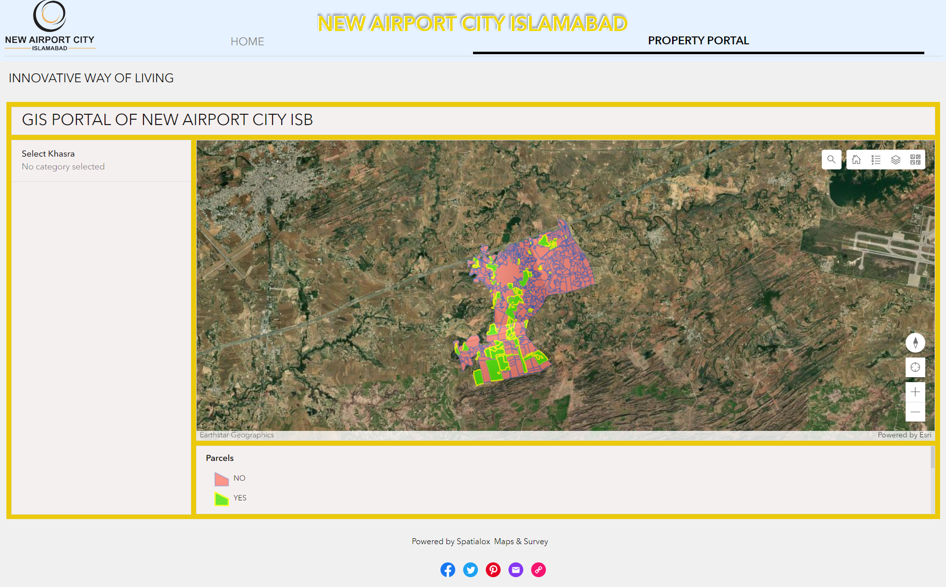
An innovative app leveraging ArcGIS was developed to enhance property portal functionality by integrating an ArcGIS dashboard
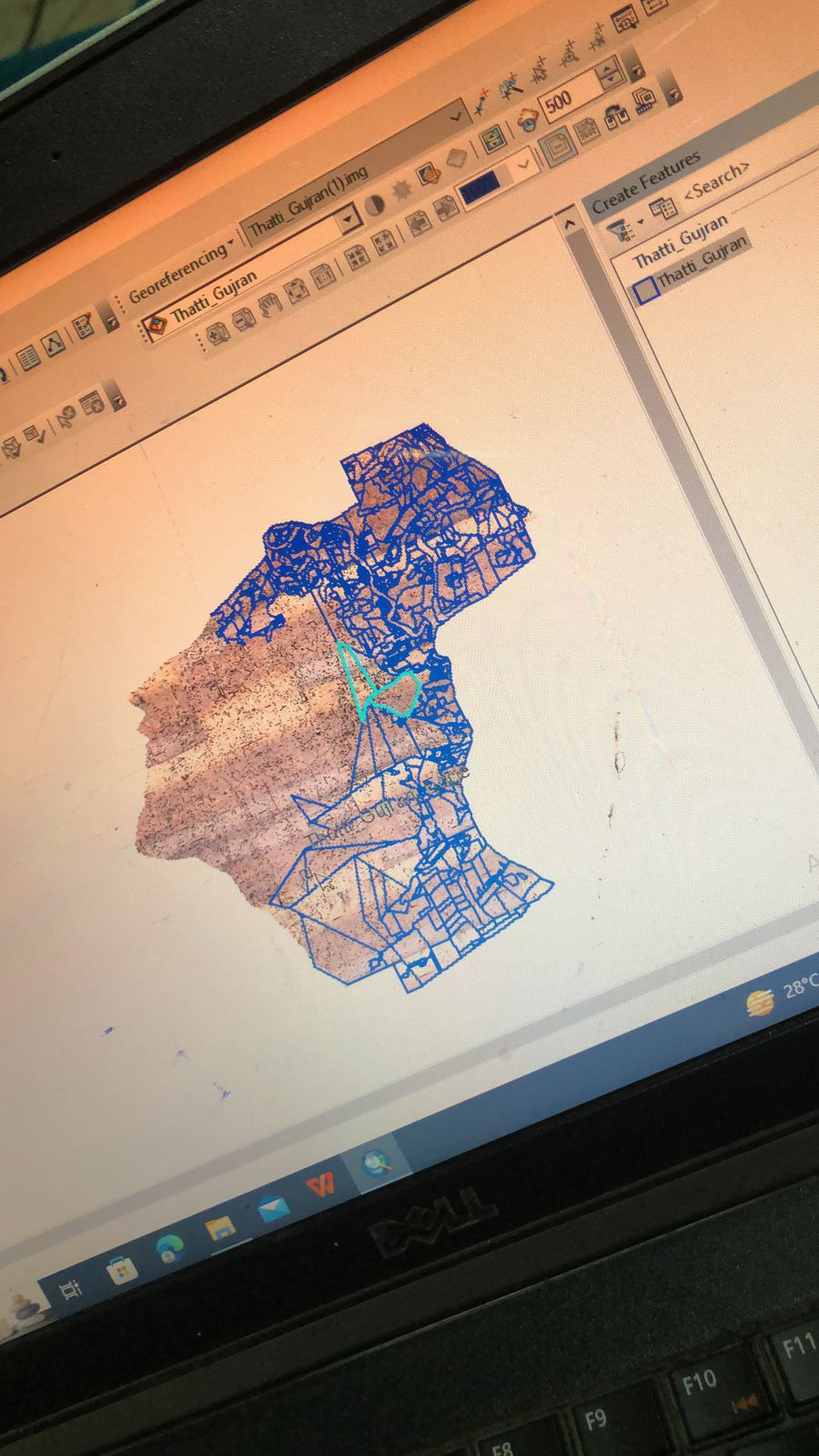
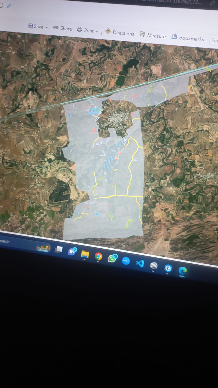
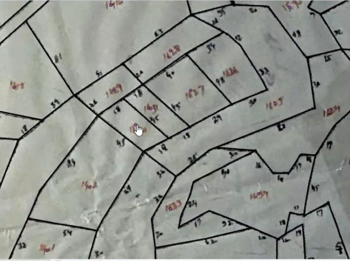
within an ArcGIS Experience. The process commenced with Georeferencing old cadastral maps,
ensuring accurate spatial alignment, followed by meticulous digitization of these Georeferenced images.
Attribute data including property owner names and APN numbers were diligently added to the digitized maps.
This comprehensive dataset formed the backbone for the property portal, enriching user interaction and data accessibility.
The ArcGIS dashboard, meticulously crafted, offered an intuitive interface for visualizing and analyzing property-related information.
This dashboard was seamlessly embedded within the broader ArcGIS experience, fostering a cohesive and user-friendly
environment for exploring property details with spatial context.
The integration of historical maps and property-specific attributes not only augmented the portal's functionality
but also provided a valuable historical perspective for property assessment and analysis.
Interactive Web Map and Repository
Please feel free to contact me at my email address or through my LinkedIn Account below.
mhwahla360@gmail.com