Muhammad Hamza

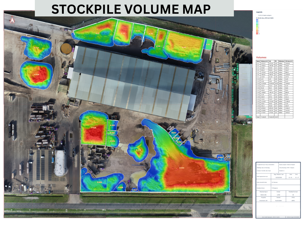
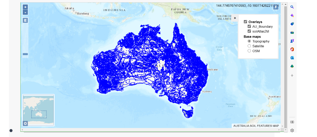
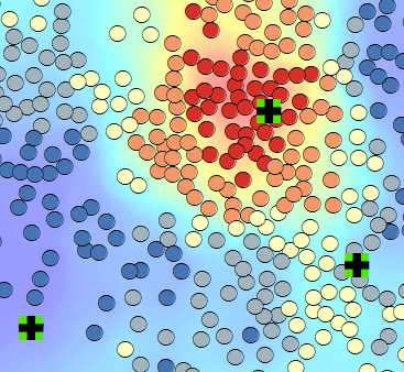
Welcome! My portfolio reveals my passion for leveraging technology and tools to transform real-world Geography into a visual art form. This journey stems from my undergraduate degree in Geographic Information Science and Remote Sensing. Dive into my professional work and experiences here

Recent Work

ABOUT ME


Greetings! I am Hamza Wahla, currently serving as the CEO of SpatialOx LLC, Founder of MapBakes and working as a freelancer on Upwork and Fiverr. My passion lies in Geo-Spatial Sciences and Artificial Intelligence, where I utilize technology to enhance understanding of the planet.

ABOUT ME


Greetings! I am Hamza Wahla, currently serving as the CEO of

SpatialOx LLC.

,

Founder of MapBakes.

and working as a freelancer on Upwork and Fiverr. My passion lies in Geo-Spatial Sciences and Artificial Intelligence, where I utilize technology to enhance our understanding of the planet.

HIGHLIGHT

1 / 4

"SURVEY OF PAKISTAN PROJECTS"

Projects I am part of in the GreenAge "Reforming and Modernization of Cadastre of cities (Karachi, Lahore and Islamabad) and State Lands in Pakistan"


Through my current role as GIS Analyst for GreenAge Services Islamabad, I am actively part of planning, preparation and execution of mapping tasks for South Punjab Region field teams and receiving the datasets from them. Projects include: Board of Revenue Stateland Archive I , Satellite Images preprocessing for stateland, Preparation of Cadastral Raster(Musavi), GCPs Survey for Bahawalpur Division, Web Portal for Cadastral stateland.

Image Credit: BOR/Survey of Pakistan
2 / 4

University of California GIS Freelance Training 2022

How to excel in GIS & RS Freelance using Fiverr


During the UC GIS WEEK Training (GISDAY) webinar, I served as a guest speaker, drawing from my freelance experience since my second year of graduation in 2017. As a Level 2 Seller and one of the top 16 GIS Experts on Fiverr, I've successfully completed 377+ projects encompassing GIS, remote sensing, and Python, maintaining an outstanding rating of 4.9*/5.0. My presentation focused on guiding all participants through the intricacies of navigating GIS freelance work.

Image Credit: University of California
3 / 4

Development of fully functional Arduino GPS Device (NEO-6M) in 2018

Decoding Satellite data format (NMEA) to extract meaningful information of specific location using GIS Hardware as a Semester project


The Arduino GPS project set out to create a tracking system by utilizing the NEO-6M GPS module alongside the Arduino Uno. This report chronicles the steps involved in linking the GPS module, acquiring raw GPS NMEA data, parsing the data to extract essential location details, and provides the project's historical context. The primary focus was on extracting key information from NMEA, including "LATITUDE, LONGITUDE, PDOP, ELEVATION, and NUMBER OF SATELLITES."

Image Credit: GIS DAY 2018 NUST
4 / 4

John Hopkins University COVID Time Series Web App 2020

Development of app using Arcgis Online for Patient status visaulization in reference to time


Johns Hopkins University leveraged the ArcGIS Online Time Series web app to visualize COVID-19 patient data, enriched by datasets curated through my freelance GIS work on Upwork. Collating information from Excel and various documents, I crafted a foundation for this dynamic tool. Our collaborative effort transformed raw data into an interactive platform, empowering researchers to monitor trends and identify infection rate fluctuations. This initiative highlighted the synergy between data organization, technological innovation, and visualization techniques in addressing the global health crisis.

Data/Image Credit: AGOL & University of John Hopkins

LATEST WORK

Check out my latest work in remote sensing, GIS, and interactive web mapping!


Contact


Please feel free to contact me at my email address or through my LinkedIn Account below.


Email


mhwahla360@gmail.com