Geo-Coding Stores of New York using ESRI'S ArcGIS
Utilizing Powerful Geocoding Service API to translate Address to Lat/Long

Team Members:
Muhammad Hamza
Project Type:
Paid
Affiliation:
Fiverr
Tech:
ArcGIS
Team Members:
Muhammad Hamza
Project:
Paid
Tech:
ArcGIS
Affiliation:
Fiverr
Project Description:
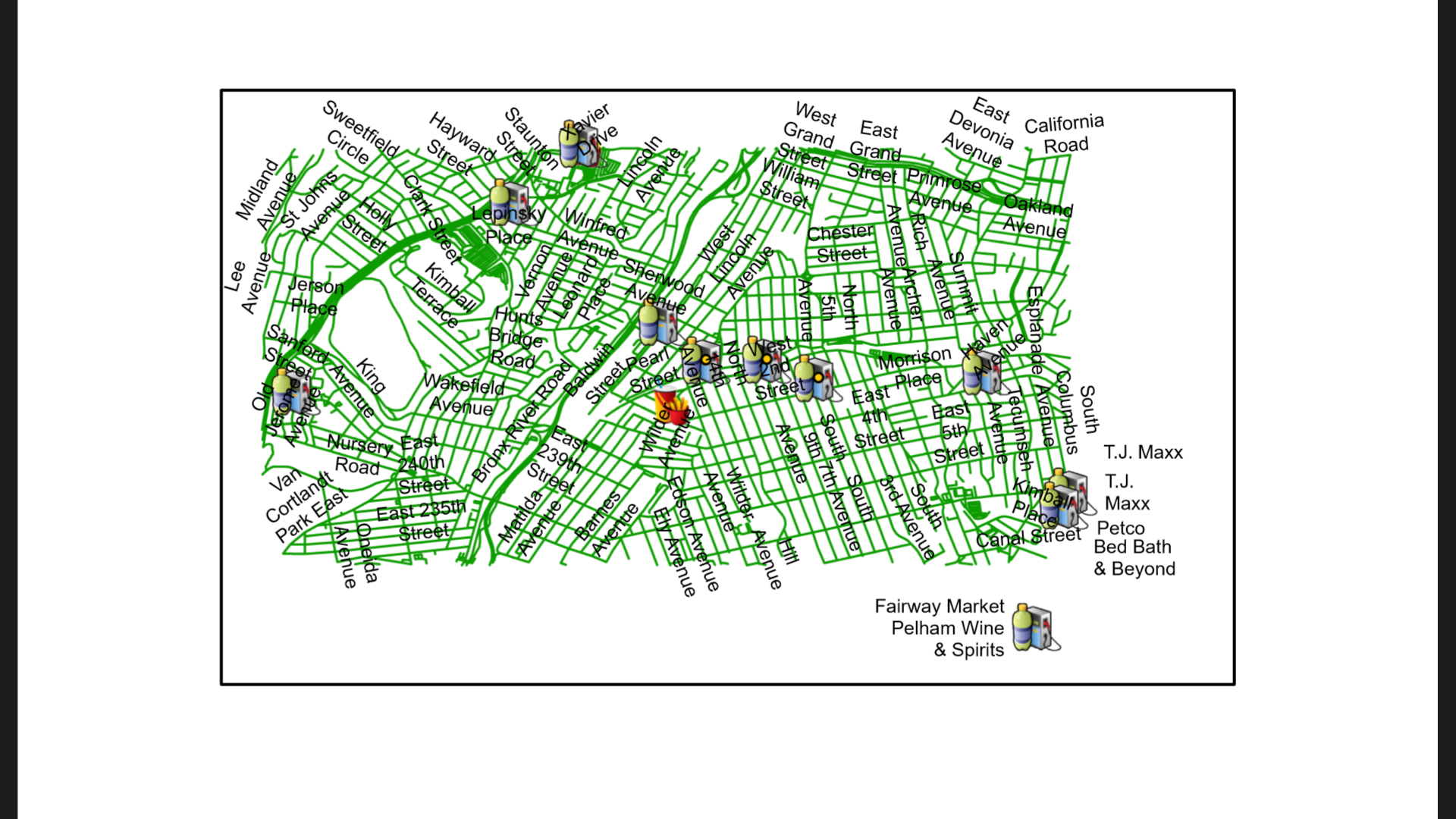
Geo-coding, the attribution of geographic coordinates to a postal address, has been a crucial geospatial solution since the advent of GIS in the 1960s. It has been a significant concern in the property insurance market for risk assessment and has gained importance in the consumer market with the ubiquity of GPS hardware and platforms like Google Maps.
Given the location "Area 14 N Bond St, Mount Vernon, NY 10550, USA," the objective is to geocode addresses of over a hundred shops, including stores, hospitals, and restaurants, each with known addresses and zip codes.
GEO-CODE NEWYORK SHOPS
Please feel free to contact me at my email address or through my LinkedIn Account below.
mhwahla360@gmail.com